
Discovered by a French naval officer after whom it is named, the 1739 discovery of Bouvet Island has since held an element of mystery to it. According to the CIA, since 1977 Norway has held responsibility for it, running an automated meteorology station amid the native fur seal and penguin colonies. According to the CIA it is uninhabited. The perfect place to hide stuff. [1]
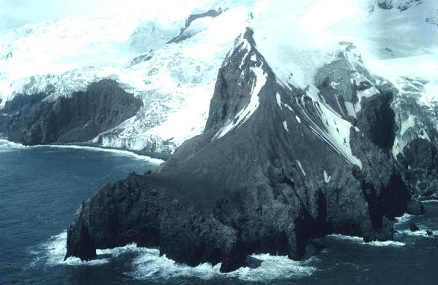
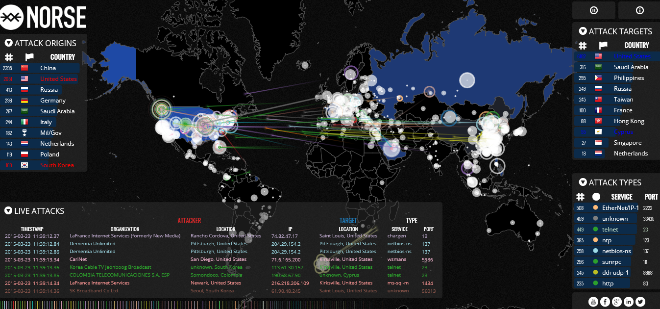
Halfway between South Africa and Antarctica, Bouvet Island is the most remote island in the world. Keep this in mind as we move on to the Norse website, where internet attack origins are noted, time stamped in real time, and shown on a comprehensive map;. The question arises why the unpopulated Bouvet Island is launching its own attacks from an ‘unmanned’ station.
Norse has marked the Island with a hexagon symbol, naming it Mil/Gov with an accompanying unknown title. Located below South Africa in it’s own isolation, it’s an active aggressor comparable to Russia and China, targeting countries such as Australia as it launches attacks indiscriminately. It begs the question: What is going on?
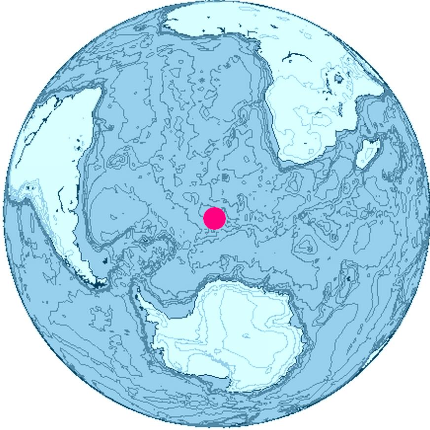
It’s not the first time that Bouvet Island’s uninhabitable environment has been in question. The Vela Incident, notated and documented by several individuals makes for interesting reading. One such essay, written by Alan Bellows, notates with clarity a mysterious nuclear event in 1979. Satellites at the time were able to pin the area to a 3000 mile radius, suggesting that it had occurred at the Bouvet Island. It was later determined by U.S Intelligence that a 2-4 kiloton nuclear device had been exploded. Needless to say, President Carter at the time, called an urgent Whitehouse meeting. The exact cause has never been released, only heavily redacted reports.[2]
[1] (2015) the CIA Library. [CIA]. Retrieved from https://www.cia.gov/library/publications/the-world-factbook/geos/bv.html
[2] Bellows, A. (2007, October 16). The Vela Incident. Retrieved from http://www.damninteresting.com/the-vela-incident/
")

OMG !!! Sounds like a James Bond movie!
Maybe it’s just a hacked server…
Less exciting than that, its a hexagon over some open ocean that shows attacks from a bunch of random (ie not Bouvet Island) IPs. Pause the map now and then and do a lookup on the IPs comung from Unknown/Military.
Unmanned my arse, I say we get some anons in south africa to take a short boat ride over there, document it properly with a small solar powered server on a mini fishing trawler video linked to some hand cameras, relay the info live to the net or to other storage somewhere around the world. May be expensive but I’d kick in £10. a few rock climbing anons, a few who can row a mini raft, a few who can run server systems and manage relays, and a couple to head the squad teams with orders or suggestions.
a man of action we have here
sounds like a nice mission!
u know thats 3000 kms of open ocean from capetown. u cant just take a rowing boat x)
Blue has killed the dream.
I did mention mini fishing trawler, easily “liberated” from a dock, or pay off the owner…
Yh let’s do it let me know when you’re ready & pick me up for an adventure of a lifetime tut tut if anyone went there I imagine they would be executed so actually. ….. leave me our this one lmao
So I watched the map and started pausing it whenever a Bouvet Island attack occurred. I wrote down a few IP addresses and looked them up. Since they don’t correspond to the targets, you’d assume they come from the island but nope. They’re all over the map: Singapore, Brasil, the US etc. Several of them also repeat the same target on the same service/port. This looks like its not so much a secret cyberwar facility as a glitch in the map’s code. Here’s some of the IPs I captured so you can check yourself. Of course it could be that the hexagon is coincidental to the island and just used as the source of any unknown attack.
45.64.129.254
107.189.139.7
191.255.228.34
162.217.113.70
104.149.7.218
192.95.25.36
179.106.99.252
185.20.91.1
185.51.166.9
also funny that when you look at google maps the island isnt in focus at all.
The devil runs this world so stop worrying